Cottonwood Creeks Sustainable Vision Plan Waco, Texas
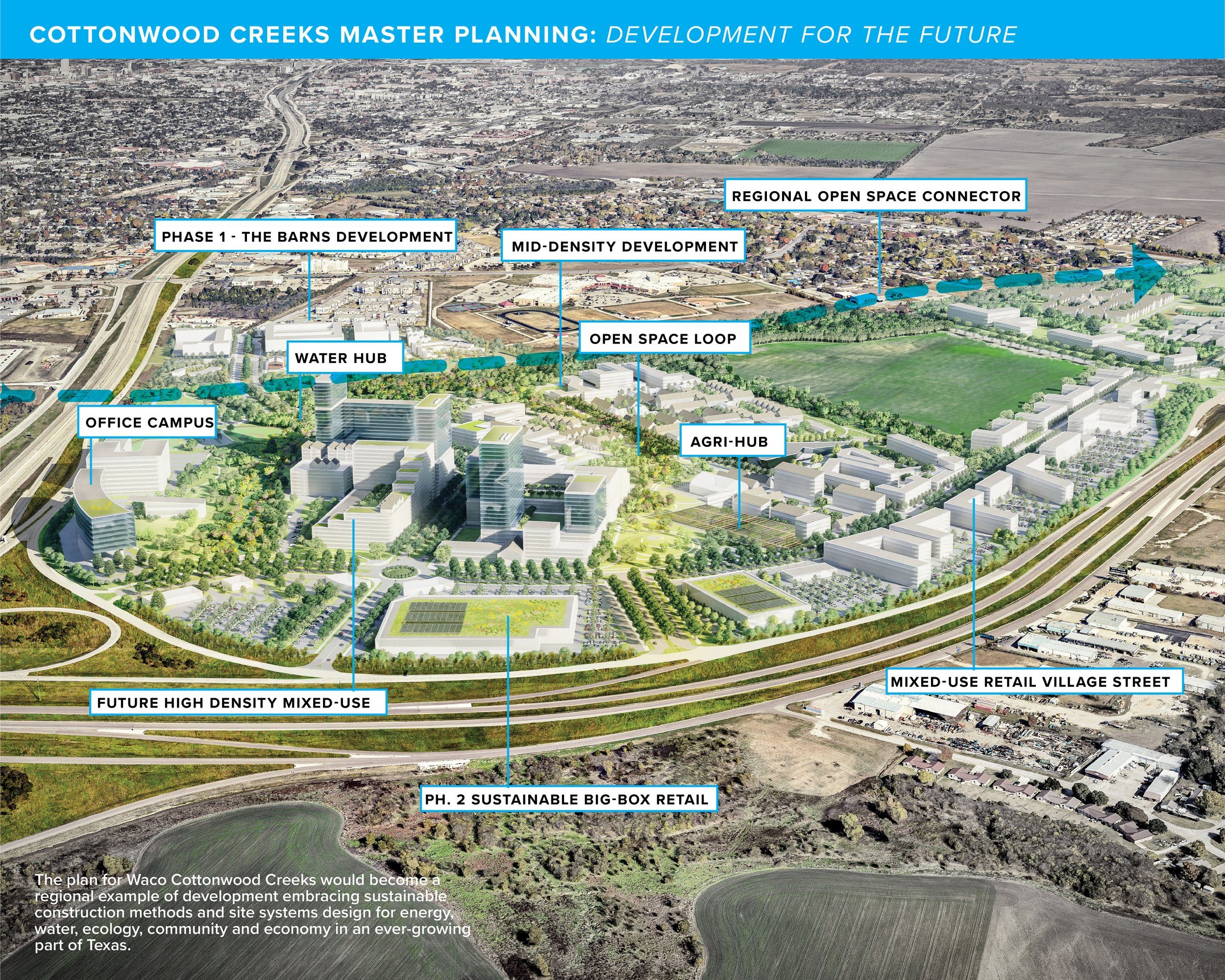
The master plan unites the Waco and Robison sites through a regional open space trail connection where loops of open space and urban pedestrian connections are priority. The Waco site address larger and denser development needs for the region and the Robinson tract would provide education and single-family housing. The vision plans water goals are to use 100% greywater reuse for non-potable needs, 100% blackwater treatment and reuse for agriculture and landscape. To minimize potable water use through technology and to export treated water through EcoHub for irrigation and non-potable uses. Sustainable systems. Sustainable planning. Women-owned planning team, Texas.
The team sought to embrace the rich community and spirit of the local culture while celebrating the landscape of Waco, Texas.
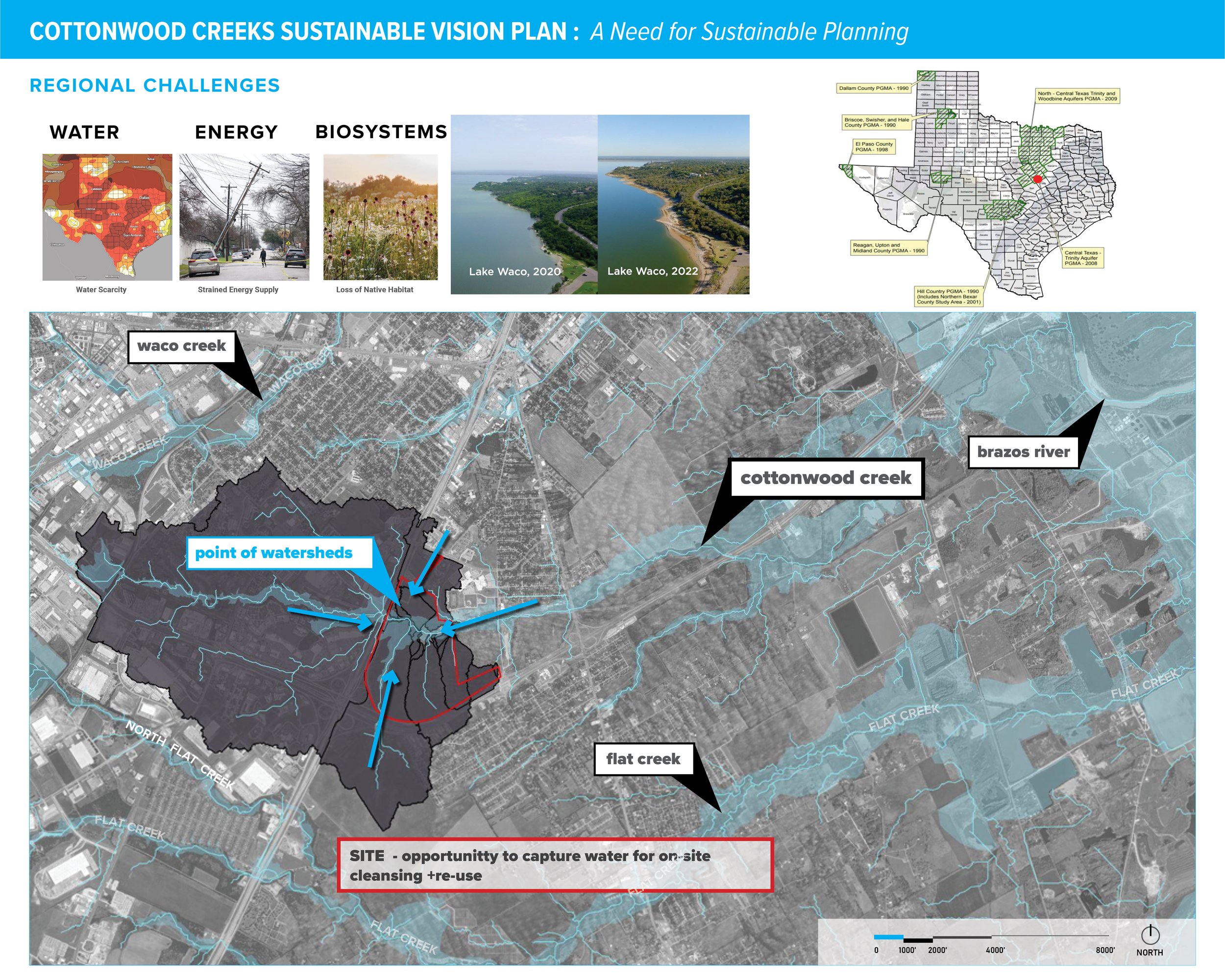
Texas is in a critical moment where growth is exceeding its ability to provide power and water to its growing population. It is financially beneficial and environmentally sustainable to consider on-site sustainable systems alongside conservation of bio-habitats. It is encouraged to develop Groundwater Conservation Districts for areas like this.
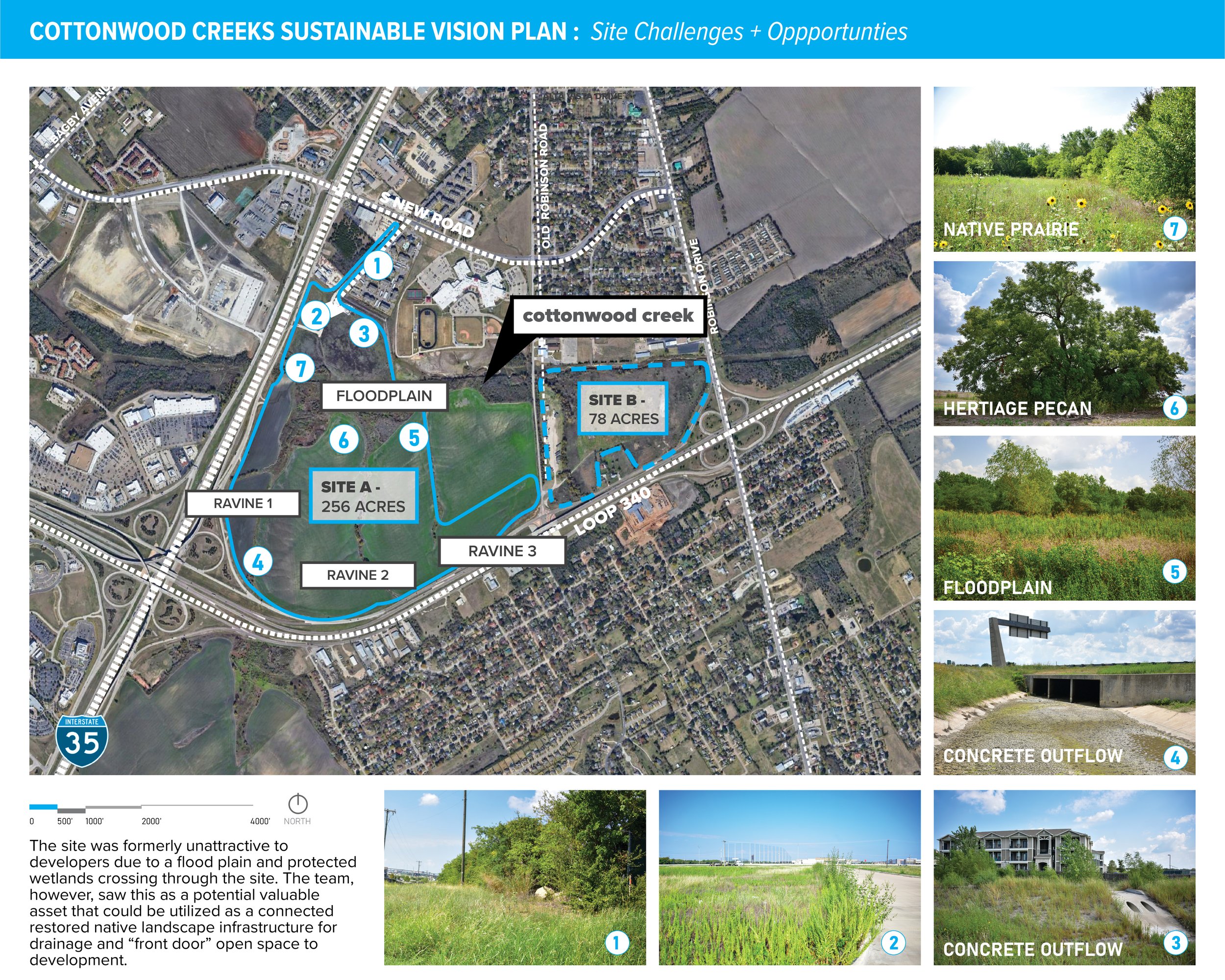
The team engaged in extensive inventory studying previous flood reports, environmental assessments, and proposed plans which showed the site had potential to utilize topography and hydrology to create valuable revenue-generating sustainable open space for the development.
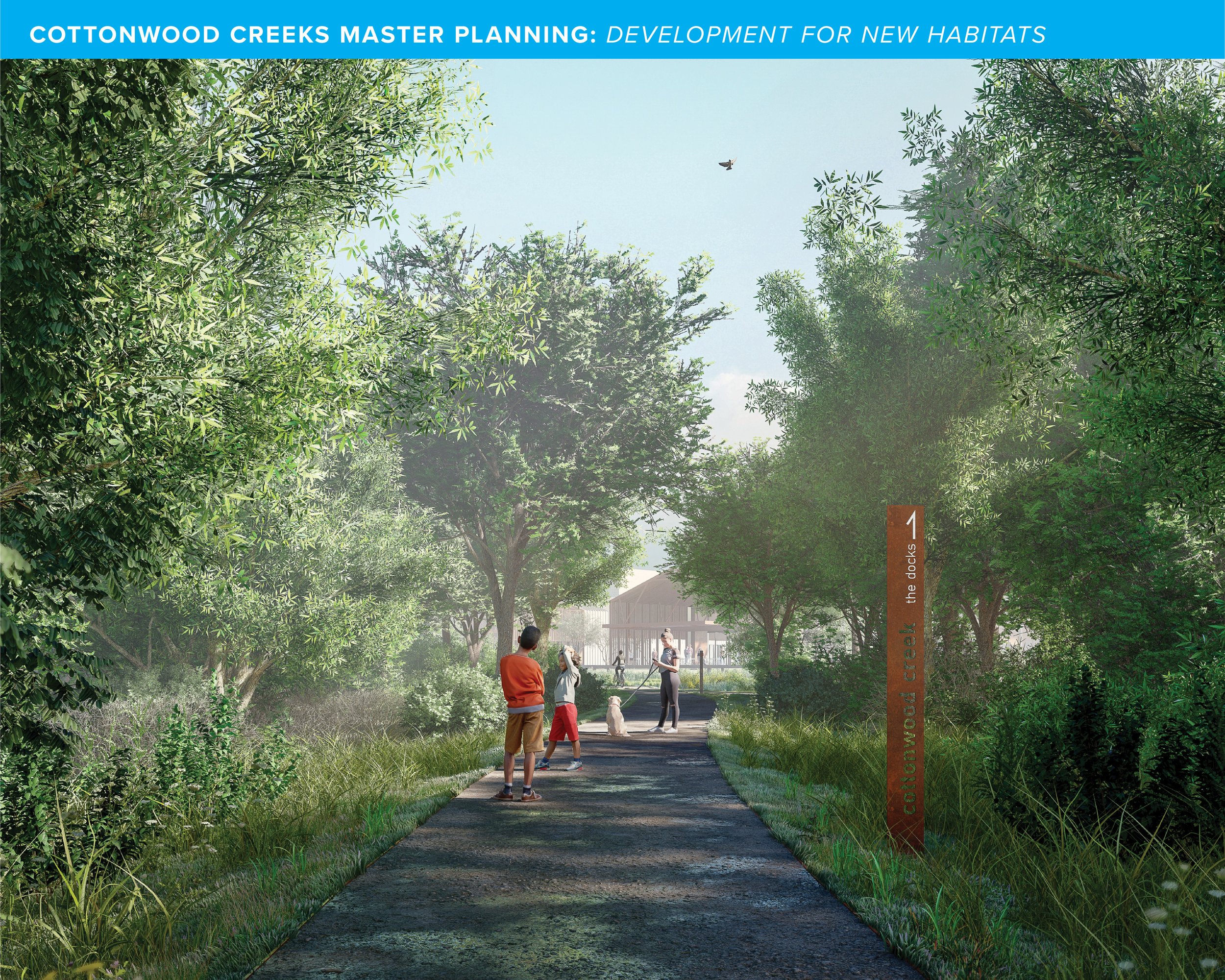
The site was formerly unattractive to developers due to a flood plain and protected wetlands crossing through the site. The team, however, saw this as a potential valuable asset that could be utilized as a connected restored native landscape infrastructure for drainage and “front door” open space to development.
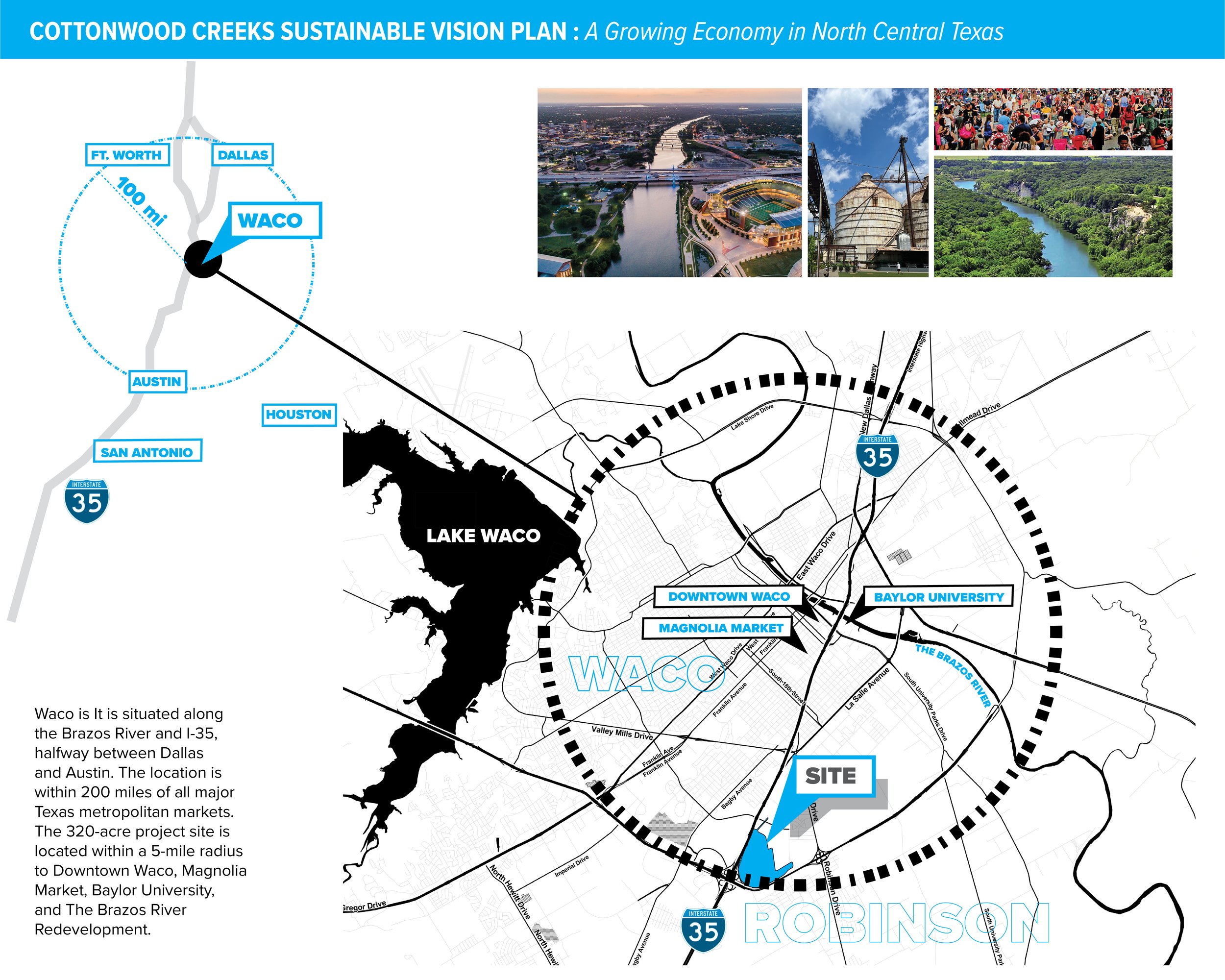
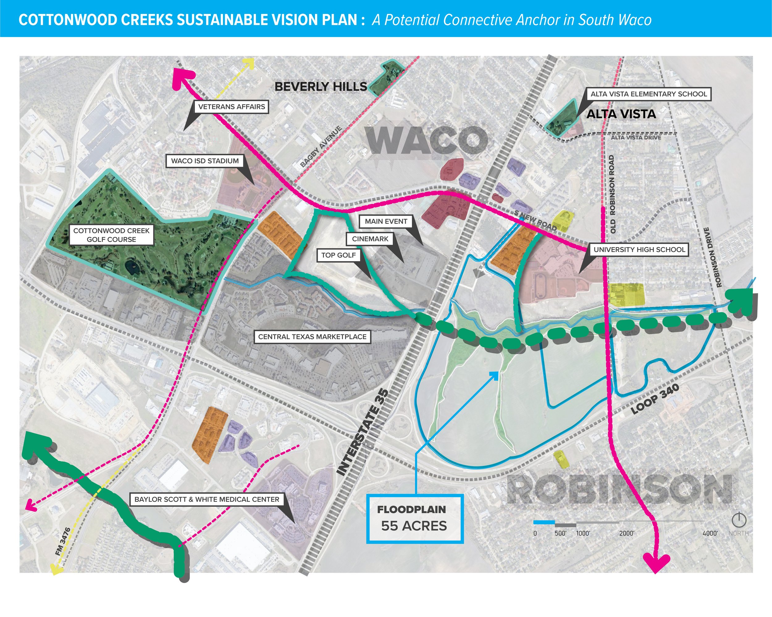
The two sites lie in different Municipalities, but can be connected by a proposed Open Space trail in the Cottonwood Creek floodplain that the team identified closely with the City of Waco’s support. The team had a market study conducted to assist in generation of the vision’s future land use.
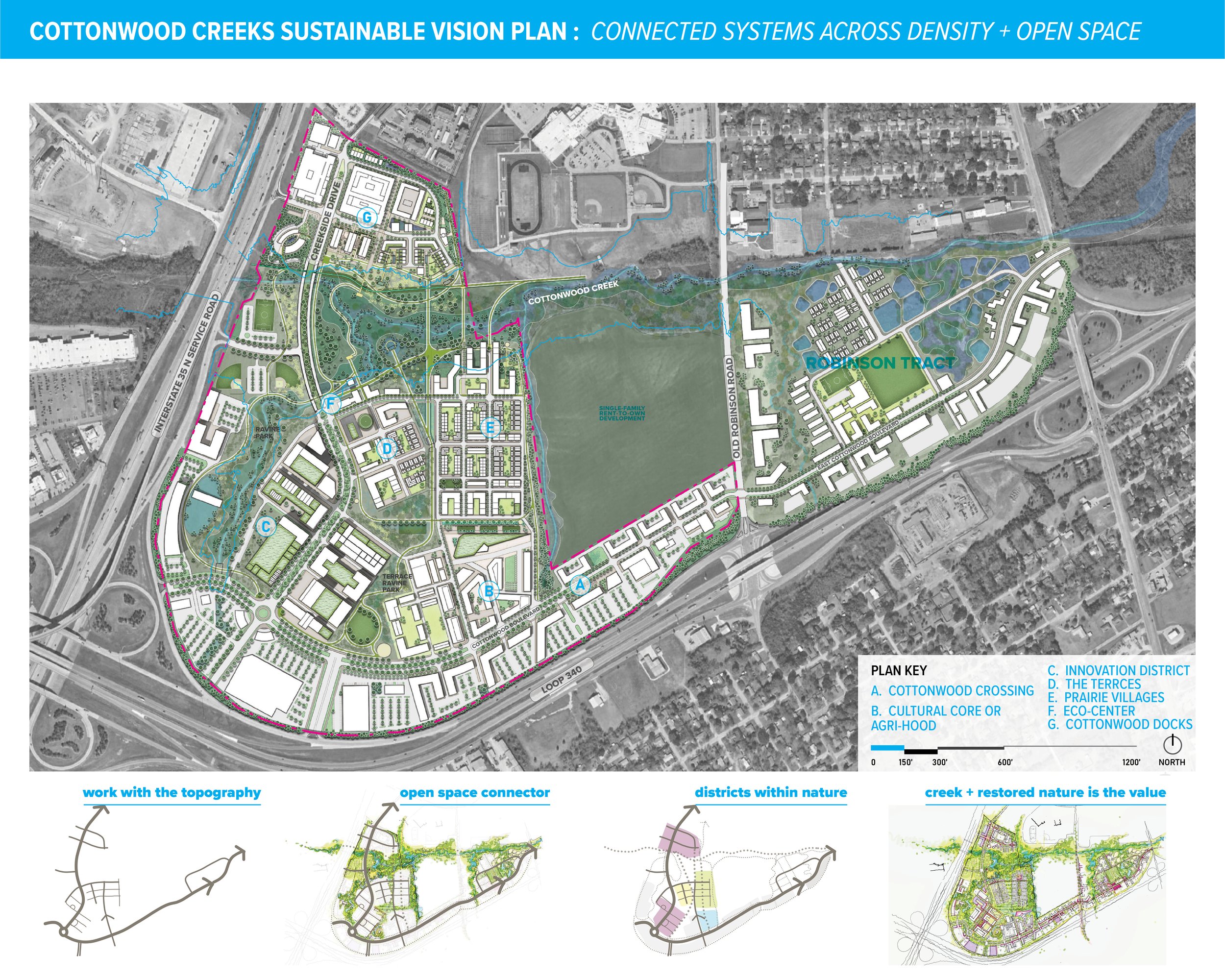
The master plan unites the Waco and Robison sites through a regional open space trail connection where loops of open space and urban pedestrian connections are priority. The Waco site address larger and denser development needs for the region and the Robinson tract would provide education and single-family housing. Both sites would center development around sustainable open-space that cleansed, captured and re-used stormwater and could treat graywater on site.
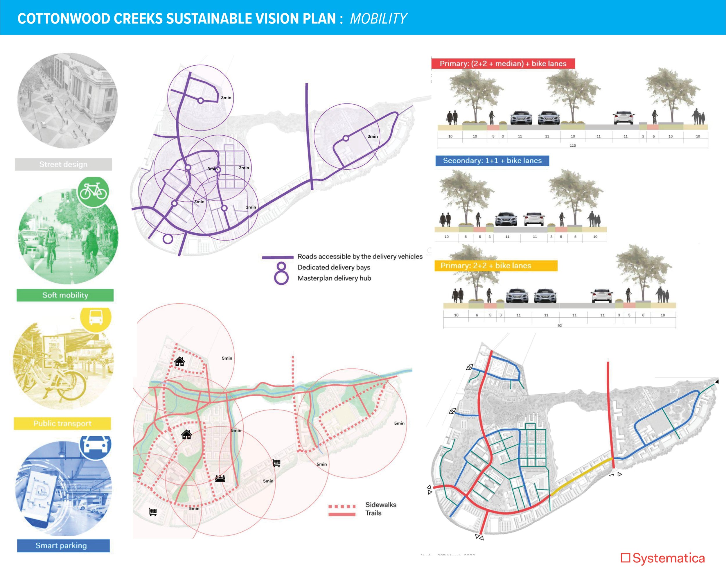
The team worked closely with a mobility consultant to study the design and impacts on different road types, pedestrian connections for maximum walkability and minimized parking in the core of the site. Given the mixed-use nature of the masterplan, logistics will play a major role in the overall mobility demand. (Exhibits above by Systematica)
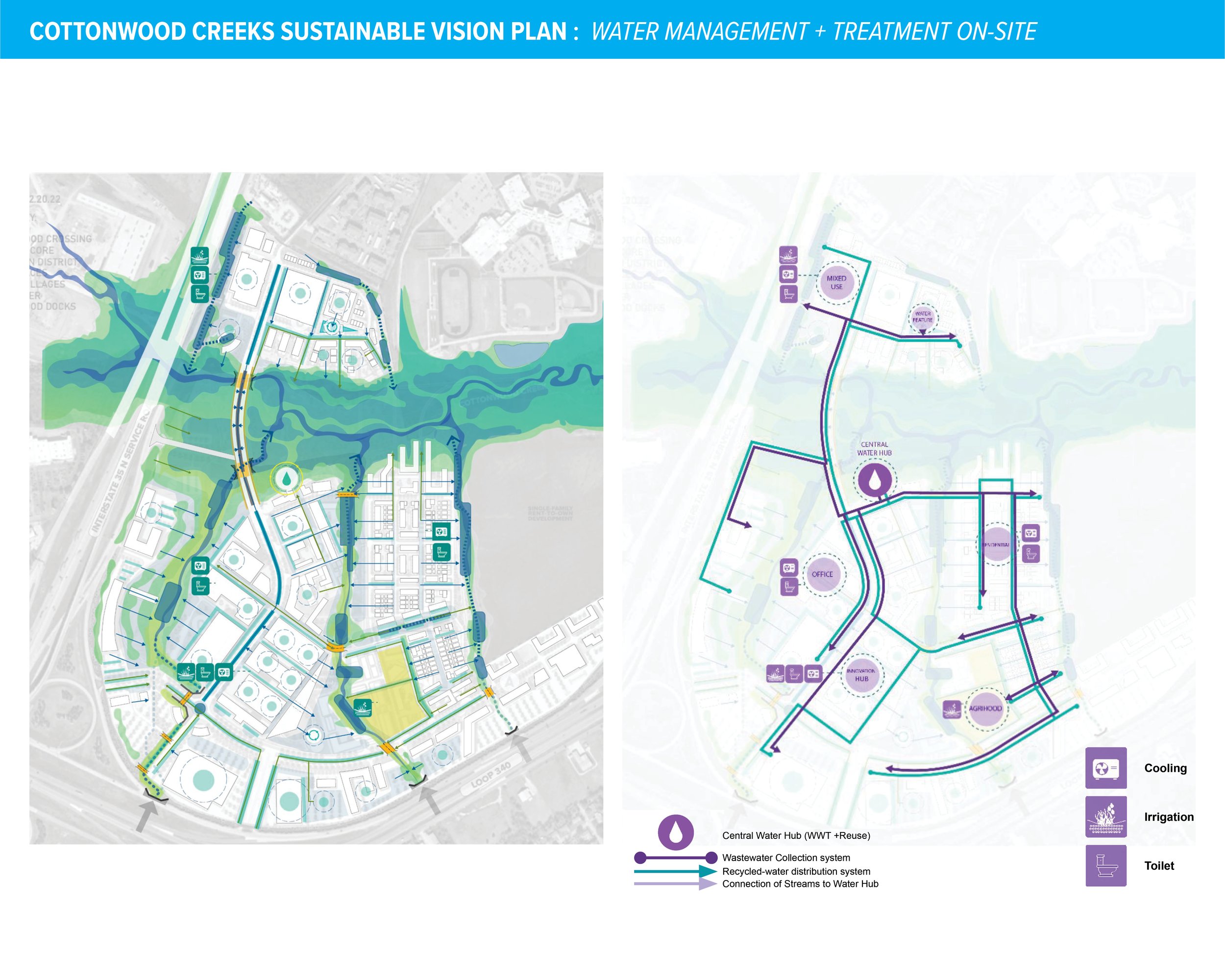
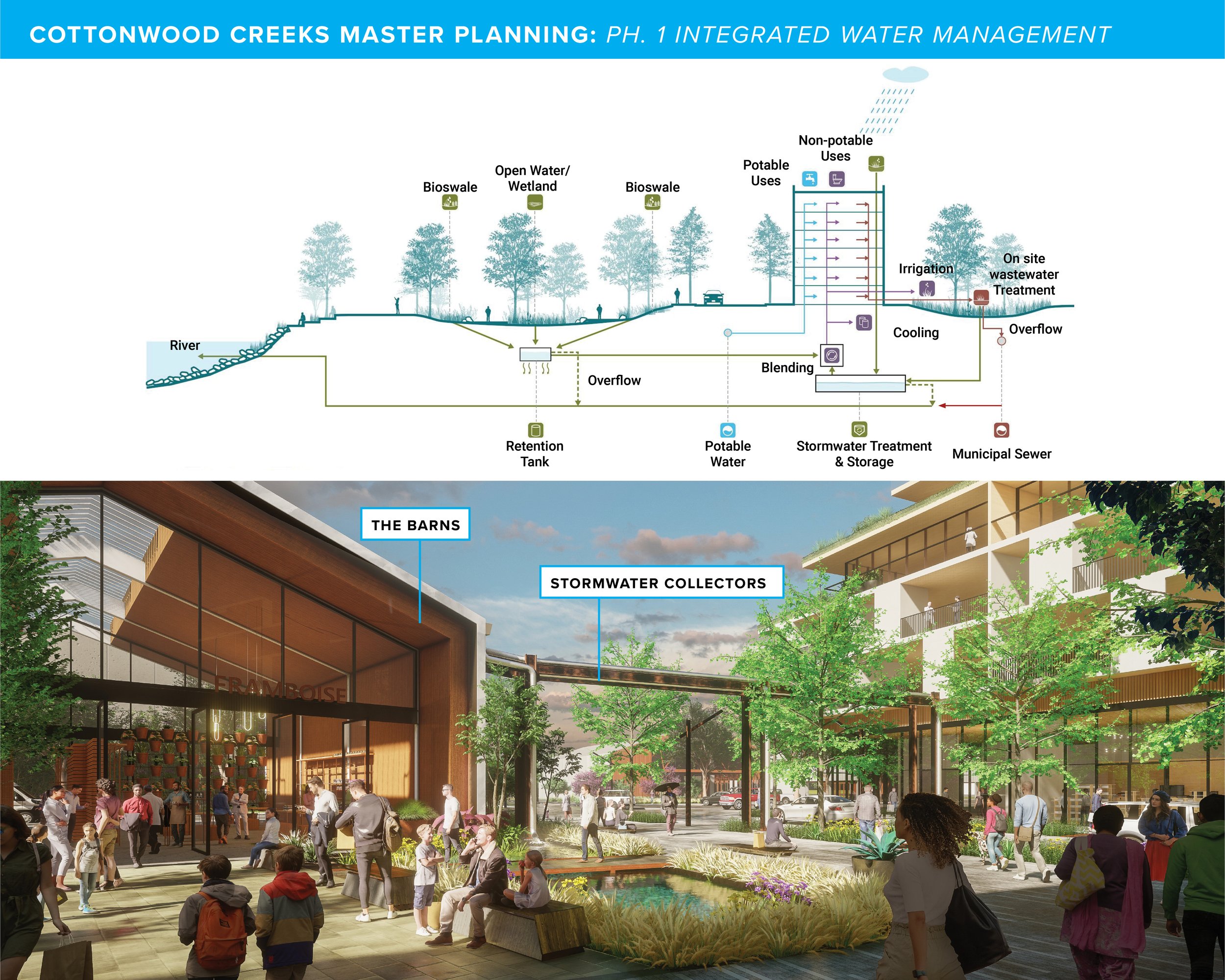
The vision plans water goals are to use 100% greywater reuse for non-potable needs, 100% blackwater treatment and reuse for agriculture and landscape. To minimize potable water use through technology and to export treated water through EcoHub for irrigation and non-potable uses. (Exhibits above by Sherwood Design Engineers)
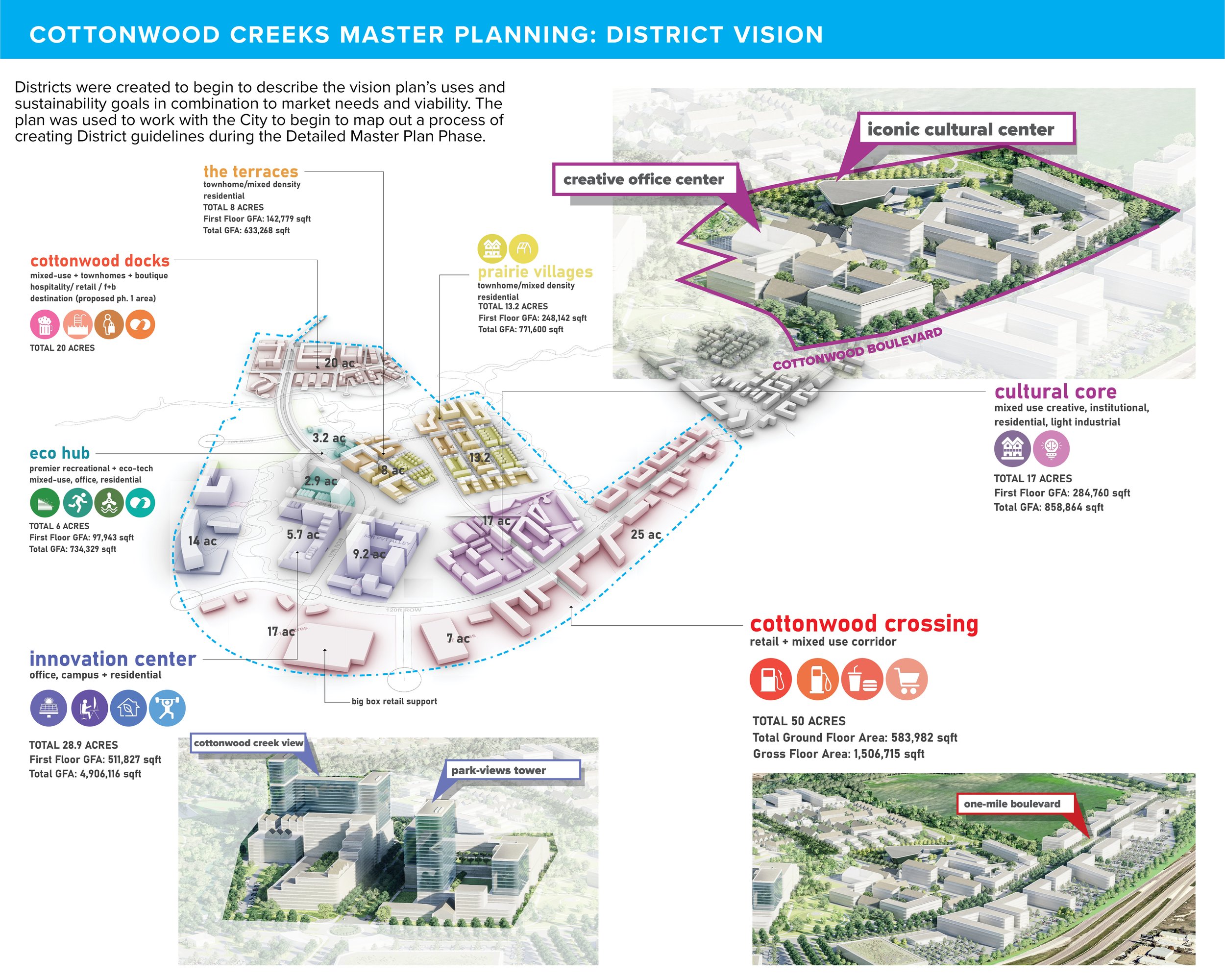
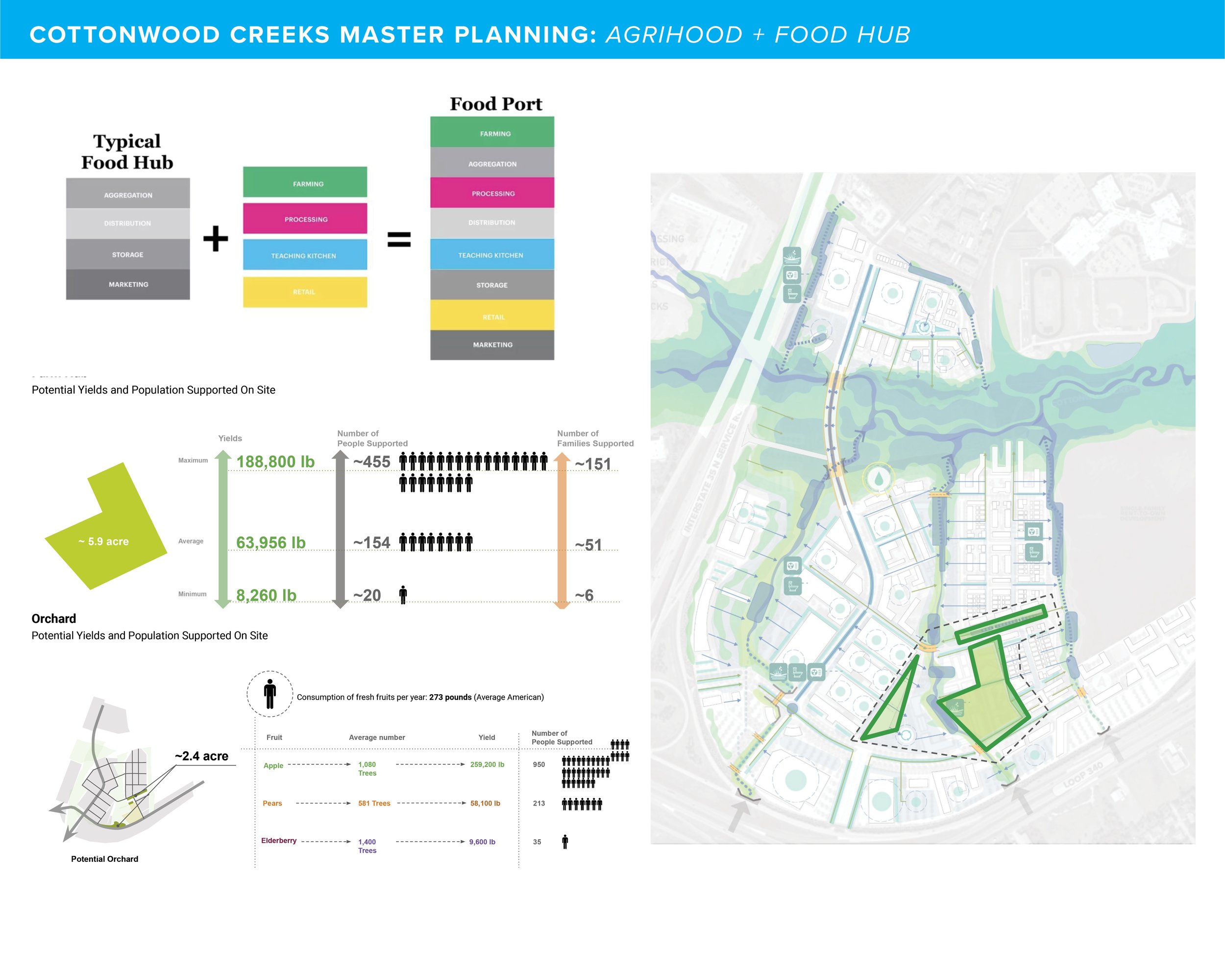
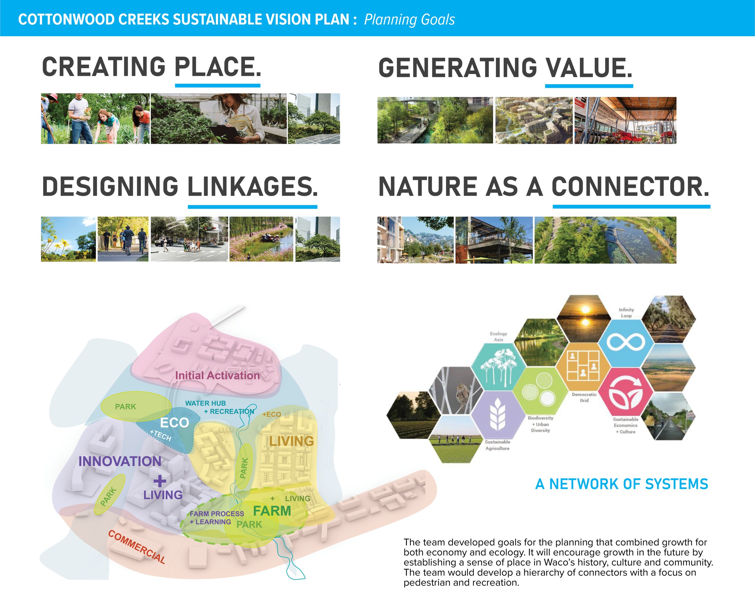
One goal of the plan is restoration of ecological infrastructure and enhancement of physical infrastructure to create circularity opportunities and integrate nature with urban. As an alternate to the “Cultural Core” the Agri-Hub could generate food locally as well as become a regional tourism and cultural even center.
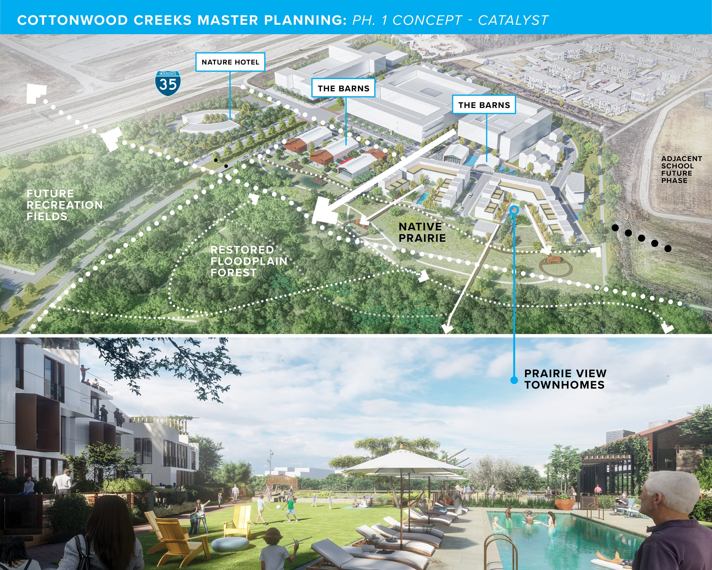
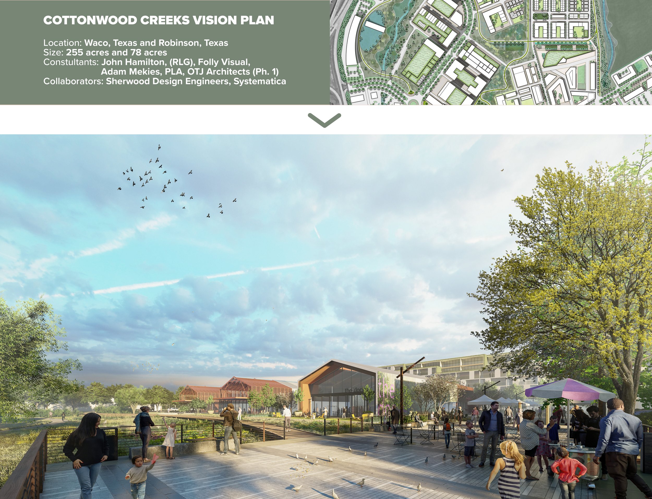
The “Retail Barns” are multi-purpose retail structures that carefully weave together a local vernacular with the ability to host local vendors, breweries, events + markets. The development for Phase 1 incorporates Water Collection Architecture-contributing to a planned overall water management system site-wide. (Rendering in collaboration with Folly Visual + OTJ Architects)
The 30-acre planned Phase 1 area was selected for its ability to be a jumpstart to development in parallel to larger flood study and detailed master planning work. The plan uses district-stormwater phased plan and situates townhomes along the prairie that takes advantage of the “backyard” of the Texas landscape.
